
Let’s go! Part 2 of the Indan roadtrip.
This part of the journey starts in Manali. (If you’re curious how I got there, check out Part 1!) I didn’t do much in Manali—mostly rested, took care of the bike, edited some photos, and planned the route for the next leg of the trip.
Manali is a quiet, laid-back town, especially by Indian standards. The outskirts of town are beautiful, surrounded by nature, and the weather is pleasant. I’m not sure how chaotic it gets during peak season, but at this time of year, it was peaceful and relaxing.

I made a stop at the local Royal Enfield service center. There weren’t any major issues with the motorcycle—it was running well—but I needed to adjust and oil the chain. While I was there, I asked them to do a general checkup just to make sure everything was in good shape before hitting the road again.


Here’s the route I took. I had to merge two maps together because Google Maps doesn’t recognize the road between Purne and Padum—to be fair, the road was still under construction when I rode it. Another section Google seems unaware of is the road to Umling La, the highest motorable road in the world. It’s a bit surprising, considering the road is in great condition and has been open for a while now.

After 2 nights I left Manali and headed north, the first stop was Jispa.
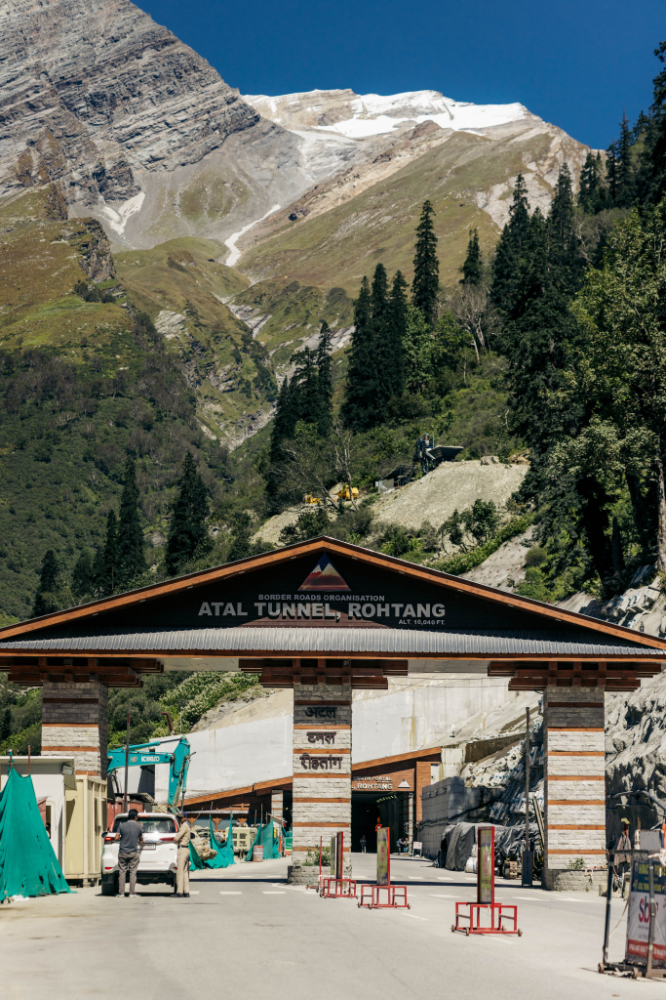
There is 2 ways out of Manali to go north, first is the pass I took to come in, Rohtang pass, and the other is the “new” Atal Tunnel.
Atal Tunnel is a 9.02-kilometre-long road tunnel connecting Manali and Keylong. It helps in bypassing the Rohtang Pass. It carries two lanes of National Highway 3. It is the longest highway single-tube tunnel above 3,048 m (10 000 ft.) in the world. It is named after the former Prime Minister of India, Atal Bihari Vajpayee.
The tunnel reduces the travel time and overall distance between Manali and Keylong on the way to Leh. The route, which previously went through Gramphu, was 116 km long and took 5 to 6 hours in good conditions. The new route via the tunnel brings down the total distance travelled to 71 km which can be covered in about 2 hours, a reduction of around 3 to 4 hours when compared to the earlier route. Moreover, the tunnel bypasses most of the sites that were prone to road blockades, avalanches, and traffic snarls.
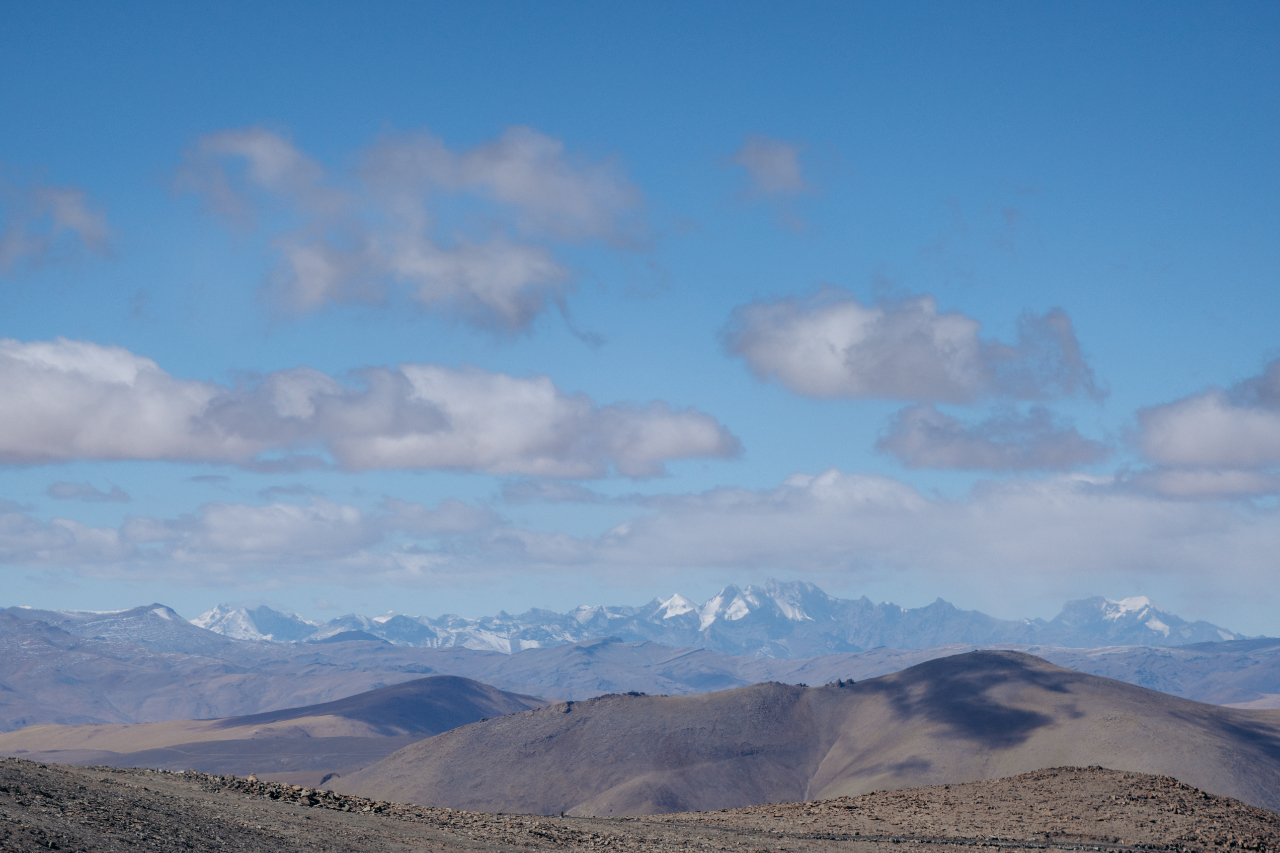
Right before reaching the tunnel, the landscape is stunning.

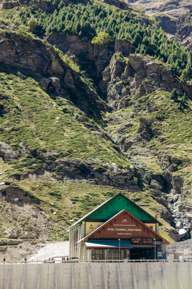
The tunnel entrance.
Inside the tunnel, it looks like this, straight line, for the whole way.

And the other side of the tunnel.
Fun experience, but I’d rather ride the pass. Obviously, the tunnel is boring and ugly. Don’t miss out the pass if you only go through this area once.
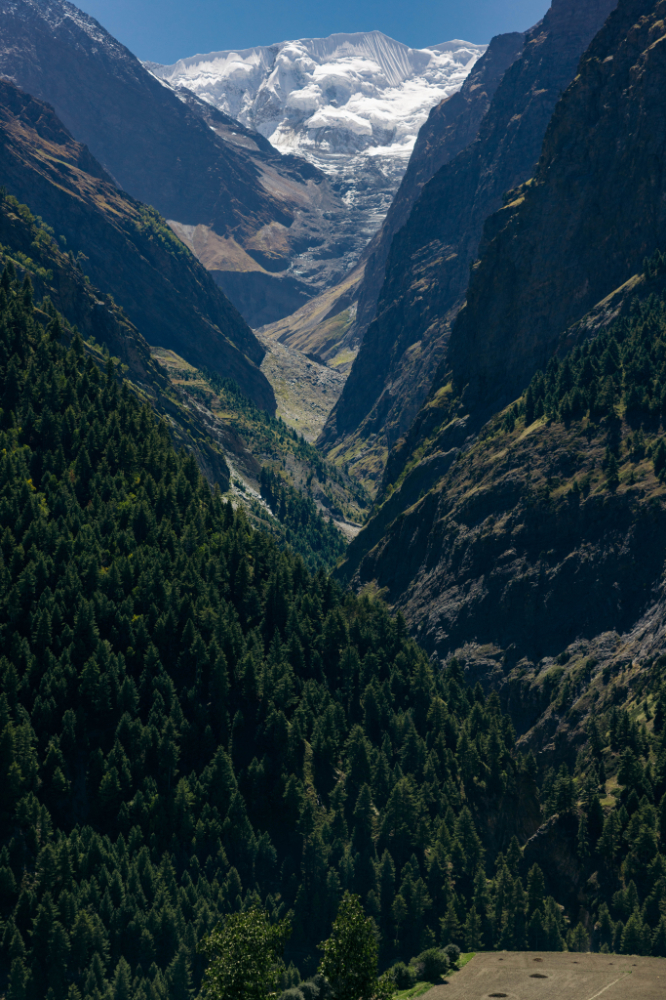
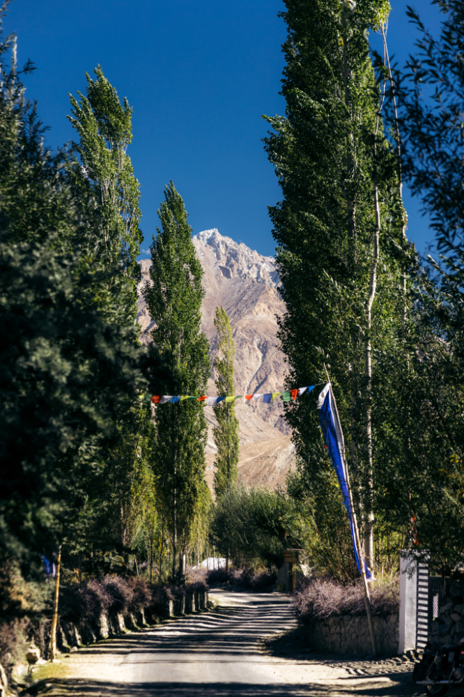
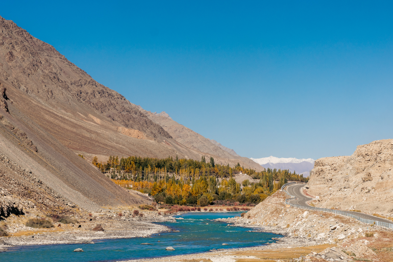
The destination for the day was Jispa, the landscape along the way is quite green and lush because of the lower altitude compared to the spiti valley.

This is the view of Jispa when coming from Manali.
I spent a night there before leaving the main road to Leh and taking a big detour toward Padum. I’d read about a road that supposedly existed, though most map apps didn’t show it. I also wanted to visit an extremely remote Gompa (monastery) along the way.
In Part 1, I kept mentioning how I was racing against time because of the weather. Here’s what I meant: this photo was taken at 8:30 AM in Jispa, at 3,200 meters above sea level. Not exactly the most inviting place to sit down in the morning—and you can imagine how chilly it felt on the bike!

Today’s destination is a village called Purne. But before reaching there, the first major milestone is Shinku La—or Shingo La, depending on who you ask. It’s one pass with two names.
The sign says Shinku La, and I finally made it there. But let me tell you, this was easily the coldest point I’ve experienced since starting this trip. The biting wind and icy air made it clear just how high up I was—definitely a moment to remember!

That’s 16,580 feet above sea level, or 5,053 meters. There was a beautiful lake next to the sign, but I didn’t stick around long enough for a swim—something about the freezing temperatures and howling wind made it less appealing! It was a stunning spot, though, even if I could only admire it for a moment before moving on.

The road from Jispa to the pass was in perfect condition.

Soon after the road looks more like this.
At this time of year, the road was in great condition, with only a few small water crossings to navigate.
I noticed a lot of workers maintaining the road and even preparing sections for asphalt. Along the way, I passed a settlement of workers—these places are so remote that people live there temporarily while they work on the road. It’s fascinating to see how much effort goes into maintaining these routes in such isolated areas.

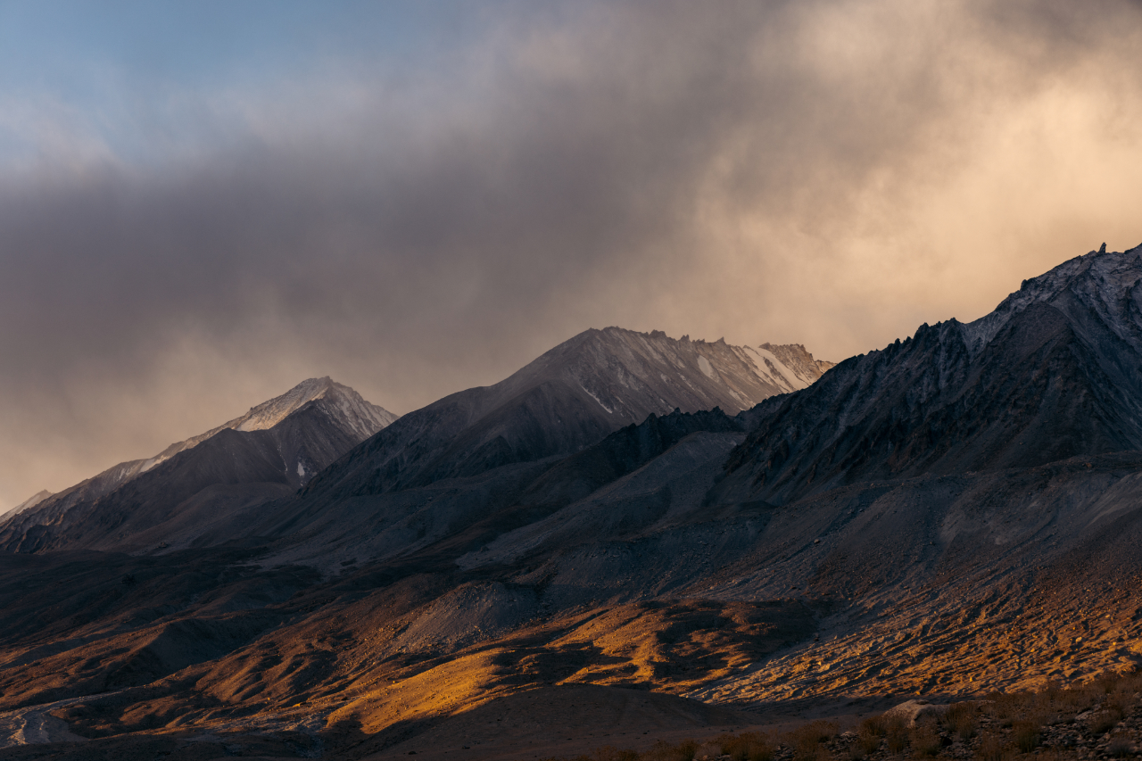
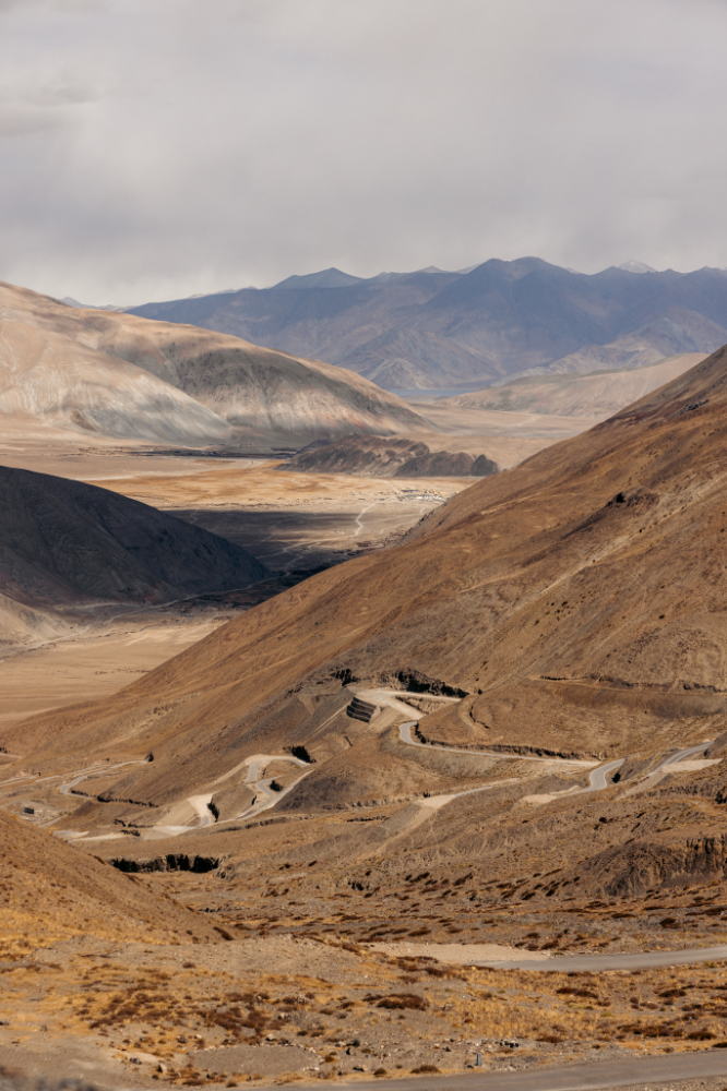
The next stop is Gonbo Rangjon, a striking mountain with a unique and impressive appearance. It’s a great spot to take a break, grab a bite to eat at one of the small shops, and soak in the views. If you’re looking to stay overnight, there are a few camps available.


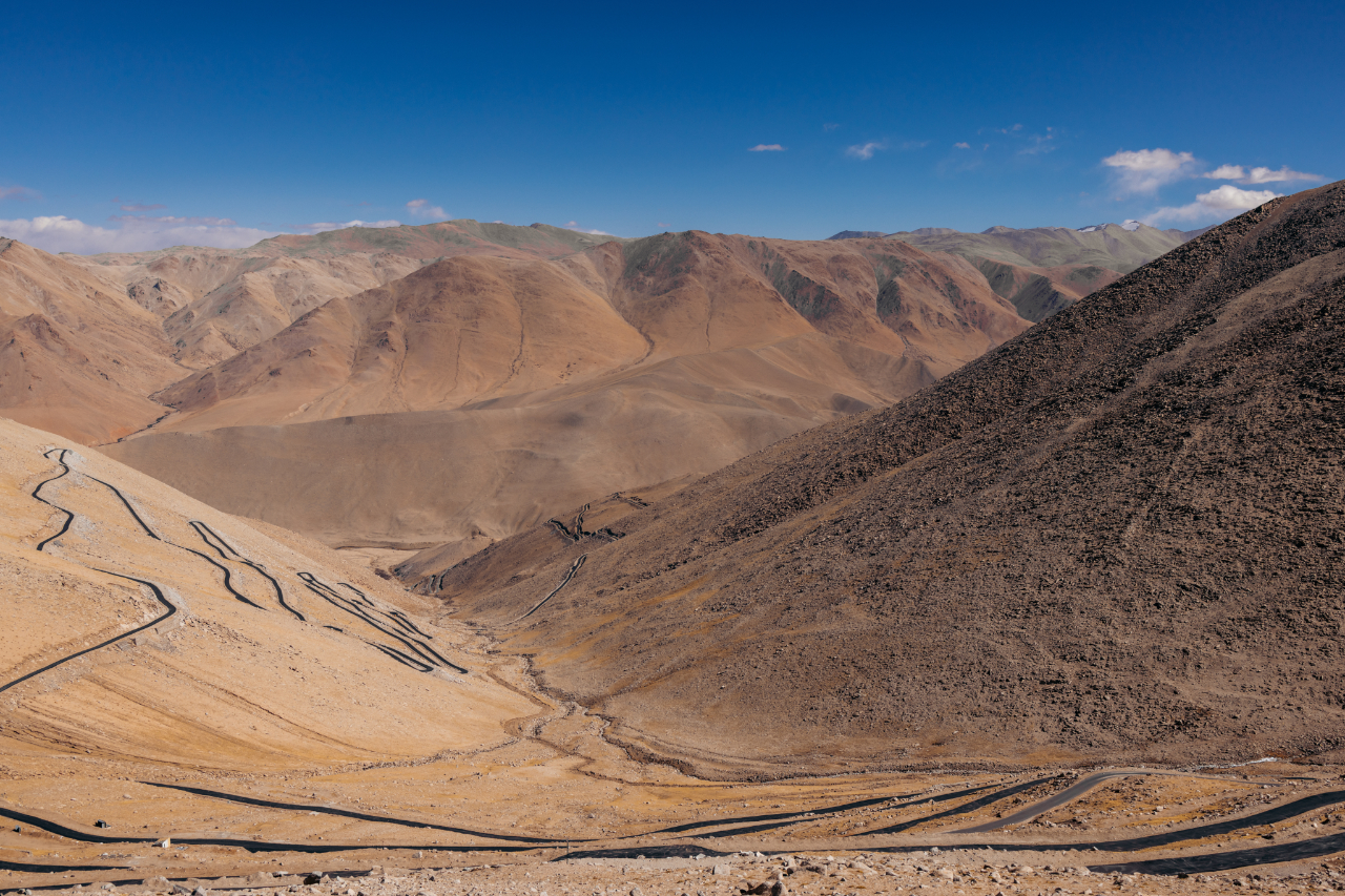
A few kilometers past Gonbo Rangjon, I came across some small stretches of good road. I pulled over randomly to take a few photos of the landscape, and as I was framing my shots, I noticed this man walking along the road. It was a quiet, almost surreal moment—just him, the vast surroundings, and the endless road ahead.

He got closer and stopped to try to talk to me, and also asked me for money. I wish we could’ve communicated in a common language, I can’t imagine how a person like this even lives in this extremely harsh place.


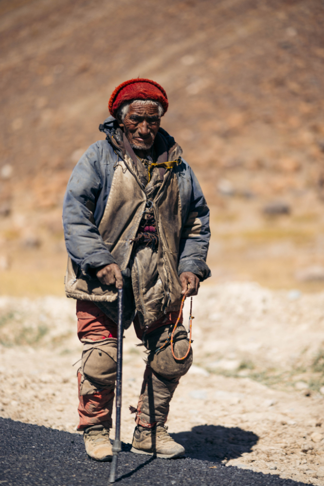
I gave him a few rupees and he just kept walking.

A handful of people live here, enduring a life without electricity—except for a few small solar panels—and no phone signal. It’s an incredibly harsh existence. Many of them leave around November or December, heading to southern India to find work. Winters here are brutal, and there’s no way to earn a living during those months. \

Preparing the road for asphalt.

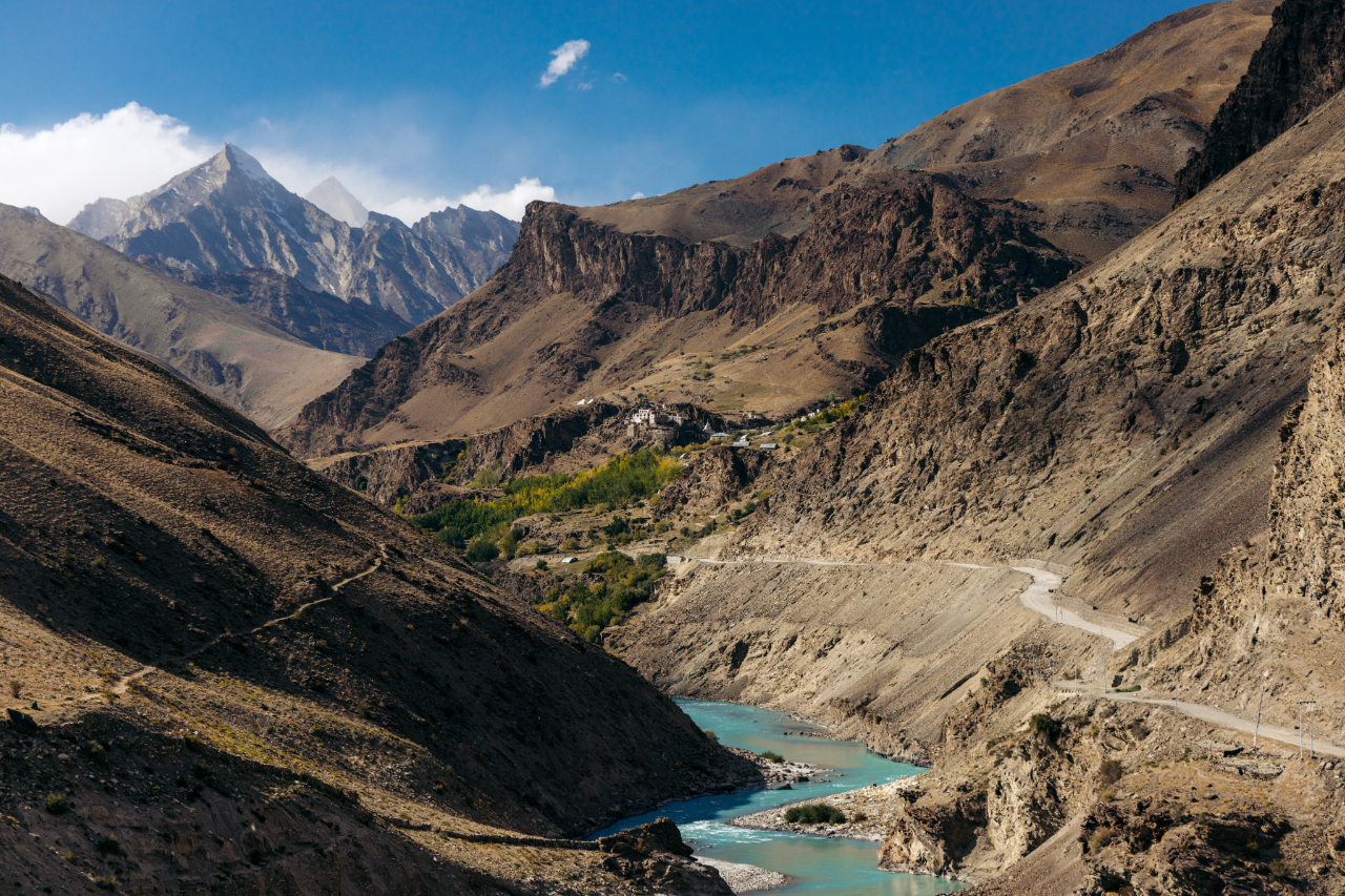
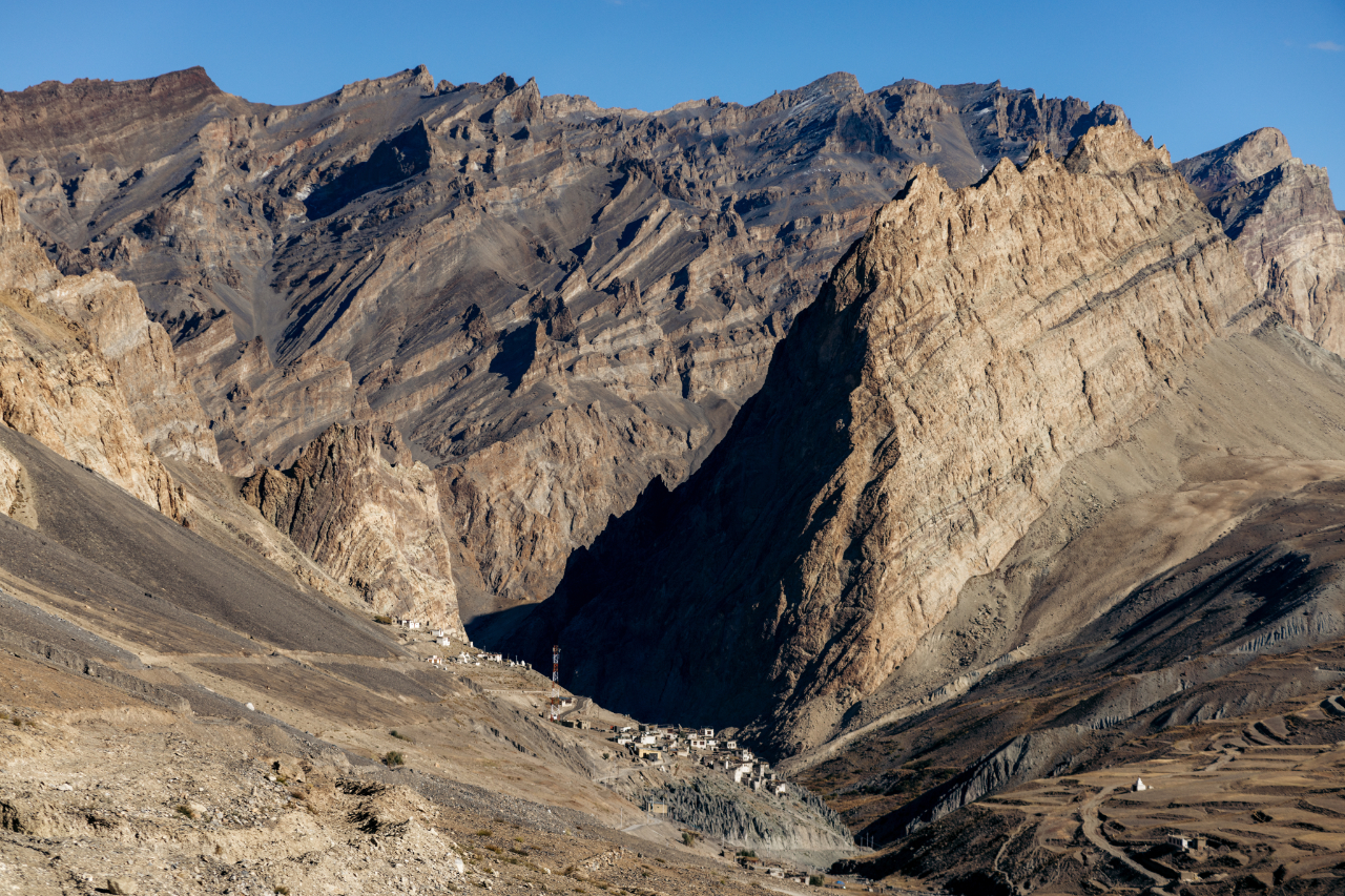
I kept riding and eventually made it to Purne. I stayed in a tent, which you can see at the bottom left of the photo. At the time, they were still building the small houses nearby. With the new road being constructed, this place is likely to see a lot of growth in the future. When I was there, access was still quite challenging, but once the road is fully operational, Purne will probably become a much more accessible spot.

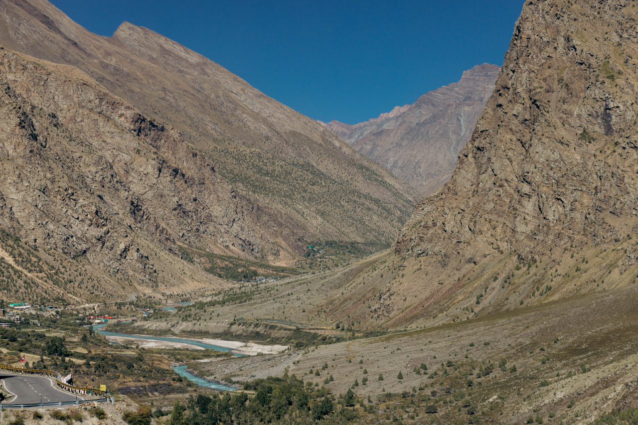
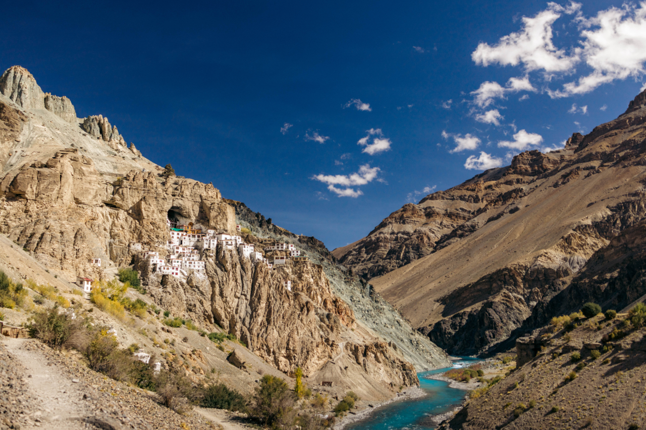
This is also the confluence of the Tsarap and Kargyak river, this is now in the Zanskar Valley, another region that is very popular with riders, but this specific is just starting to get a bit more accessible, the Tsarap river really has a beautiful color.


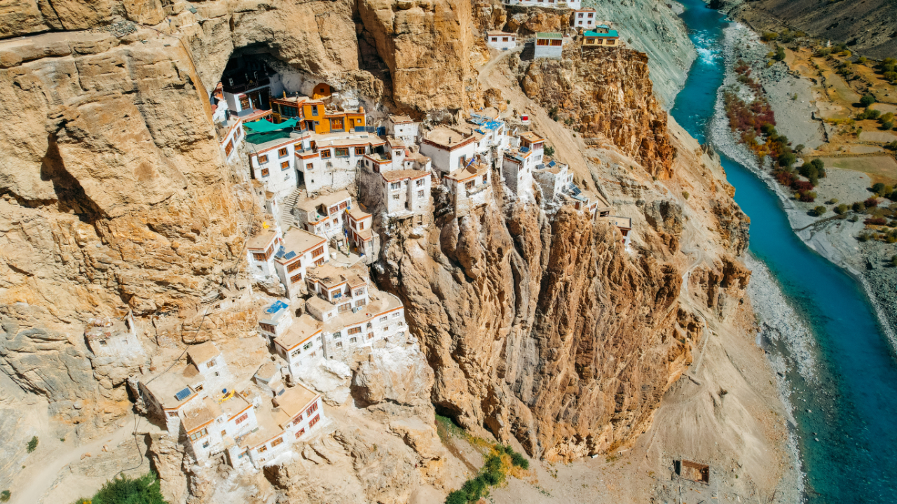
I came all the way here because I heard of Phukthar Gompa a few days before, actually saw it on Instagram.
The Phugtal Monastery is an extremely isolated place, it’s unreal that they were able to build this many years ago. There has been monks who have been praying in the cave where the monastery is now built, more than 2250 years ago.
The Phuktal Monastery is built around a natural cave, which is believed to have been visited by numerous sages, scholars, translators, and monks around 2,550 years ago. The remote location of the monastery was ideal for monks looking for peace and solitude to meditate. The present Phuktal Gompa, of the Gelug school of Tibetan Buddhism, was established in the early 15th century by Jangsem Sherap Zangpo, a disciple of Je Tsongkhapa. Tsongkhapa was the founder of Gelug, which is one of the newest schools of Tibetan Buddhism.
After a night in Purne, I rode the last bit of road to reach the monastery. The road doesn’t go all the way to the monastery, you still have to walk about 2-3 hours to reach the monastery from the end of the road. And the trek is not exactly easy at this altitude but it’s mostly flat.
Before the road was built, it was a day’s walk from Village Chah or Village Khangsaar, the end of the road leading from Padum.[1]
It’s hard to understand the amount of work to build this a few hundreds years ago with no road or machinery.
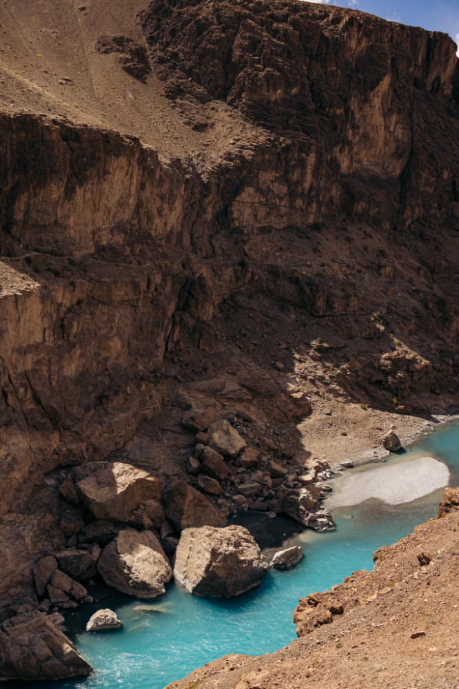
The trek is very beautiful has you walk along the amazing Tsarap river, and I was also alone for most of the walk, which makes it even more of an amazing experience.
The first sight of the river.

Unreal water color, this is at about 3900 meters above sea level.

You have to cross the bridge at some point, there is an old bridge that is not usable anymore but they built a new nice one recently.


The first sight of the monastery. There is also basic accommodation at the entry of the village/monastery.

You can see the cave that has been used for thousands of years by the monks on this photo. These drone photos are really horrible for some reason. Sorry about that.
This man has been trekking for weeks in the area and was returning home.

That is the gate to get in the village, monastery. Then I got the first sight of it with my own eyes.
It’s almost unreal to think that this monastery was built hundreds of years ago without modern roads or machinery.
It took me 2 hours to reach the monastery from the parking lot.

What a place, sadly, that day, no one was at the monastery, everything was locked up and not a single soul in the area. It was a little creepy.


The cave. When I was there, the inside of the cave wasn’t very clean, sadly.


Inside one of the rooms of the temple. Also locked, had to take this photo from ouside.
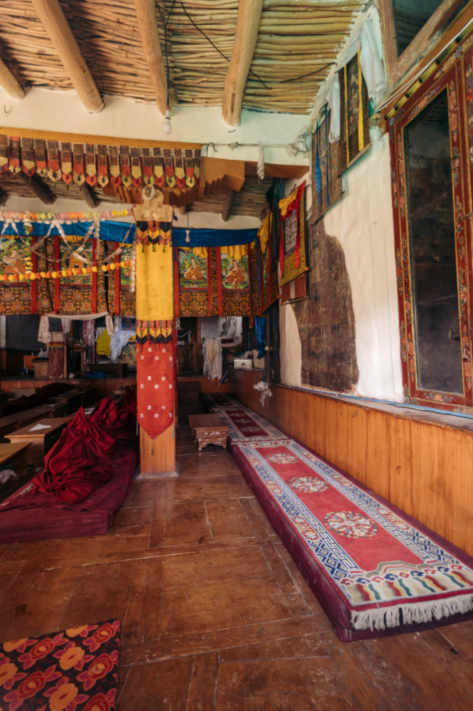

Very impressive place.

On the way back you can see a better view of the bridge(s).


As I was leaving I came accross some people, some of them were doing pretty wild things on the broken bridge, I guess when you have faith in your gods you don’t think you can die.

The path looks like this most of the way.


What a place!
After walking back for about 2.5 hours, it was time to ride out to Padum. It took almost 4 hours to reach Padum from the Phuktal monastery parking lot.
But it was another amazing stretch of road. I did have to stop a few times for some photos.
You can see the road on the right side.
Those peaks are amazing, and the tiny remote villages, what a view.

If you like mountains, this is really a place you should visit.

I made it to Padum, that place was a disaster when I visited, the whole city looked like it was bombed a few weeks ago, construction and trash everywhere.
The lobby view was nice tho.

When you reach the region of Ladakh, your Indian pre-paid sim does not work here.
I asked the reception of the hotel, and they send me a guy to sell me a local sim card that will work in Ladakh.
If your passport doesn’t have your home address in it, which I think most don’t, they will not give you a sim card at the store, so I had to deal with this guy who kinda let me borrow his “information”.
It took more than 3 hours, but in the end he made it happen. What a clusterfuck.
The next morning I wanted to go from Zangla to Wanla, they are building a new road that cuts through instead of going all around the Zanskar valley. From Wanla you can get back on the main road, 1, to reach Leh afterwards.
It wasn’t clear if the new road was open yet, but I decided to give it a shot—and it turned out to be the right decision.
Leaving Padum behind, I set off, ready for whatever the road had in store.

The first part of the road, very impressive.


After about two hours, I reached a fork in the road and was trying to decide which path to take when two bikers arrived. It was a father and his son. The son, Valentin, had been riding his Royal Enfield Himalayan from Austria to India for about nine months, and his father had flown to Delhi to join him for the Indian leg of the journey.
After chatting for a bit, I decided to ride with them since we were heading to the same destination. It felt much safer to travel with other riders in such a remote area—this was easily the quietest road I’d ever been on. Throughout the journey, we didn’t encounter any other riders and only saw a handful of vehicles.


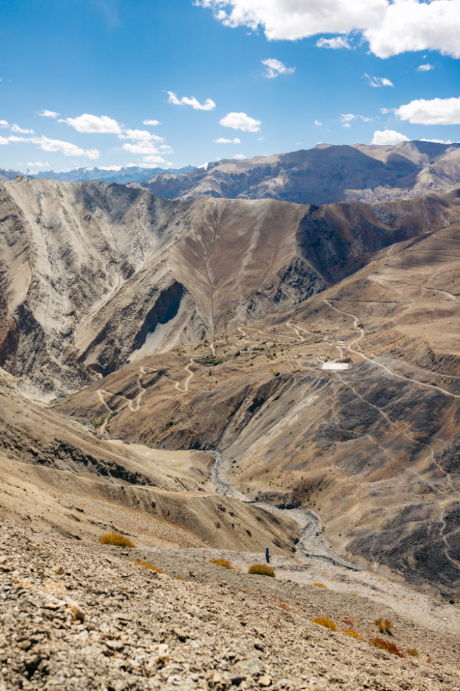
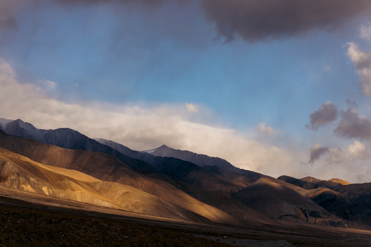
As you ride, you pass through villages that feel completely isolated from the rest of the world, untouched by time. The surrounding landscape is surreal, almost otherworldly, as if you’ve been transported to another planet. It’s an incredible experience, one that leaves you in awe of the raw beauty. The day was long and demanding, but every moment felt worth it—truly rewarding in ways that are hard to put into words.

As we reached the top of the first pass of the day, Singe La, we came across some construction work, with fresh tarmac being laid down. The scale of this area is hard to grasp, you can imagine it a little bit with the trucks.

My bike with my 2 friends for this ride.
Locals riding in a local bus having a break, eating on the ground.

The pass sign was covered with prayer flags.


We kept riding.

With new roads and cell towers these place are less and less isolated.
We made it to the second pass of the day Sirsir La.
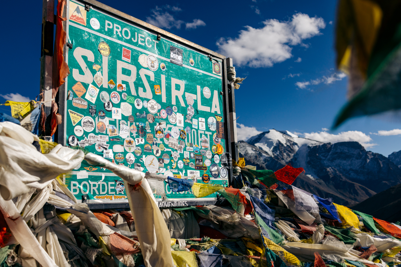


The sun getting lowe and lower so we had to get going and stop taking photos every 5 minutes.

We ended the day in, Khalsi, a small village on road 1 to Leh. We had a good evening chat and went down hard quite early.
The next morning, we went our separate ways, and I continued my journey to Leh. As the largest city in the Ladakh region, Leh is a great spot to take a few days to rest, recharge, and take care of some errands.
Few shots on the way to Leh.

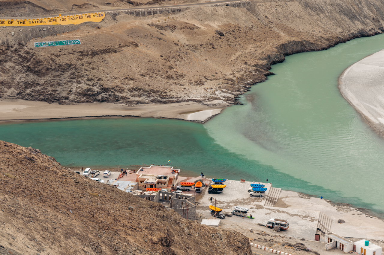
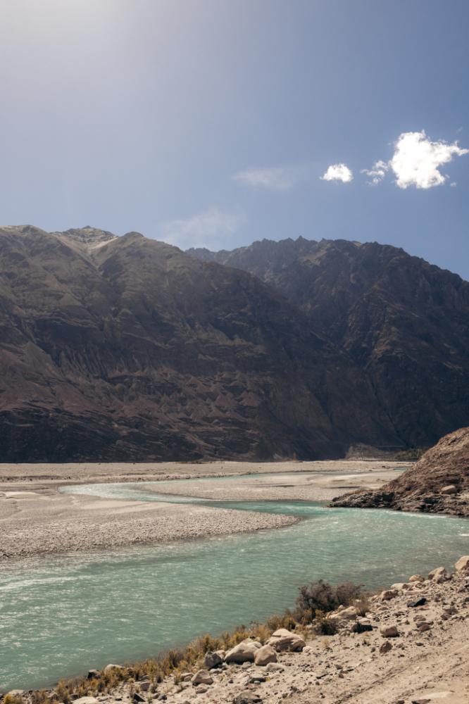
Another river confluence, where the Indus and Zanskar rivers meet, and a good spor for rafting it seems.

Beautiful valley.

In Leh, I mostly rested and edited photos before heading to the next part of my journey—the Nubra Valley.
Leh is a fascinating city with plenty to explore, but it also has a darker side—what I like to call the ‘Motorcycle Mafia’ (haha). Here’s the scam: If you rent a bike outside Leh and try riding it into Nubra Valley, a group of thugs will stop you just outside the city and force you to rent one a motorcycle in Leh instead.
They usually lurk around this spot—but if you’re smart, you can take a detour and avoid them. Even though my bike wasn’t a rental, they still harassed me before finally letting me pass.
After that hassle, I crossed the legendary Khardung La, but I didn’t stop for photos—my bike was acting up again. And sure enough, as soon as I reached the top of the pass, the engine died. So I had no choice but to coast downhill for 30 minutes, gliding silently through the mountains. Honestly? It was kind of an epic way to descend.
Then… my first glimpse of Nubra Valley


The motorcycle was on and off for the rest of the day but I was able to reach my destination for the day, without a clue of what was happening.
Made it to Diskit.

At sunset, this view was from the homestay.
The next day I rode the motorcyle around the the valley.

At one point, I stopped to refuel, and the gas cap popped open very strongly. I thought it was strange, but it wasn’t until a few days later that I realized what was really going on with my motorcycle. A few days prior, in Leh, I had an issue with the ignition switch, so I took it to the Royal Enfield service center in Leh. They replaced the ignition switch along with the key lock—which comes as a kit including the gas tank lock/cap and the rear seat lock.
But here’s the problem: The mechanics at the Royal Enfield service center installed a kit from a newer model that didn’t have a vent in the gas cap. This created pressure buildup in the tank, blocking fuel flow. That’s why I kept having intermittent issues. One morning, before starting the bike, I called a mechanic from Diskit village to take a look—and miraculously, it worked perfectly after his inspection. Later, once I figured out the real issue, I went back to him, and he fixed it brilliantly by making a small cut in the gas cap’s rubber seal to allow ventilation.
Anyway, back to the adventure!
The next day, I headed out to explore Hunder—a small village nestled among sand dunes.


This place is also famous for something quite strange to see here, camels.
These camels were introduced to this area of the silk road and still here to this day. Very cool.


After 2 nights in Diskit I rode in the direction of Turtuk, the last village a foreigner is allowed to ride to before the Pakistani border.
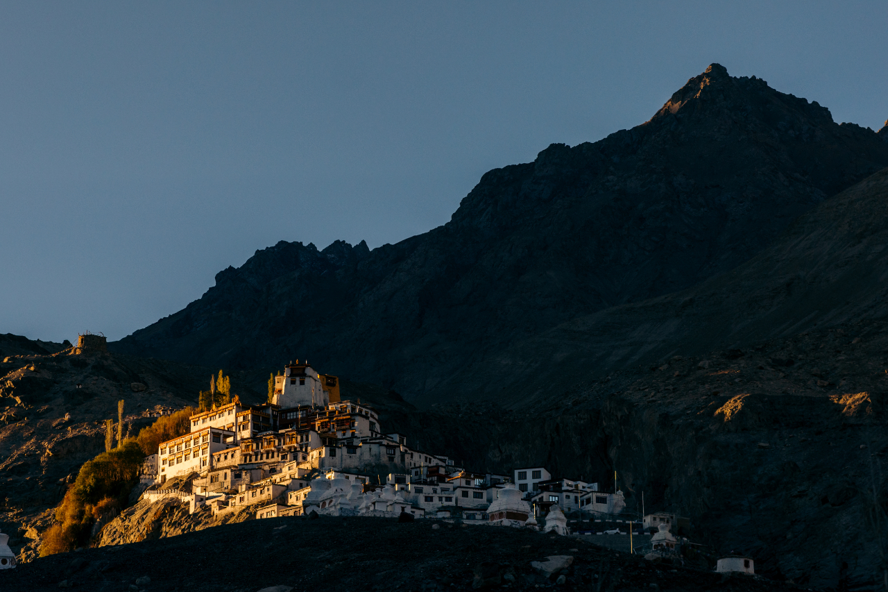
Right before I left Diskit I did visit the monastery.


Cool views from the monastery.


The road to Turtuk.


I stayed in Turtuk for one night, and it wasn’t great. The village had a really strange vibe, with a lot of people acting aggressively toward the camera.

It’s a shame because there’s some intertesting history with a old king living here. The palace is pretty well mantained and quite nice.


And the streets are very nice.


This is where the Himalayas and the Karakoram moutain ranges meet.

It’s buckwheat harvest season.


There’s another village closer to the Pakistani border, where you can look out into Pakistan, the village name is Thang, but if you’re not Indian they won’t allow you to visit. I even offered to leave my passport, and the guy told me to turn around.


After that I rode back to Diskit for a night and then continuing my adventure towards the famous Pangong Tso (lake).

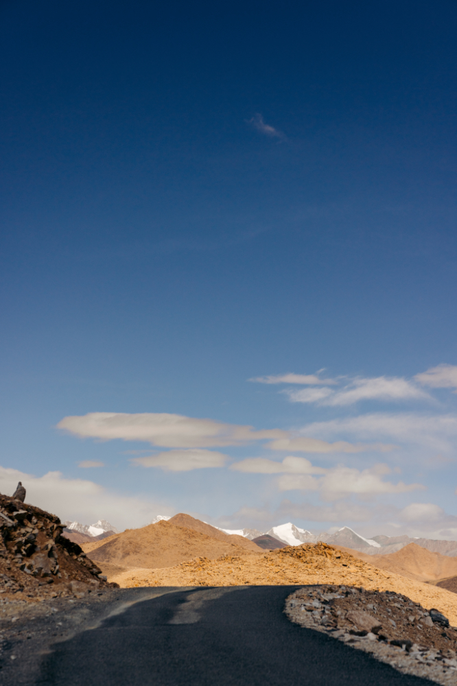
Most people will go around the mountain range but I heard the mountain pass, Wari La, was open and mostly paved now, which was quite recent as it was still being worked on as I reached the top. This pass was 5312 meters above sea level.
It was getting extra cold at this point, october 9th, not the best time to be that high in altitude but sometimes you just have to deal with it.
Traffic on the pass was still very minimal.

Stopped for a quick photo and kept going.

The other view on the other side of the pass was amazing.


After a quick lunch at a lower-ish altitude it was time to get on the next pass, Chang La (pass), a more famous one for people going to Pangong Tso (Lake), this one is at 5390 meters.
The road to get there was another unreal scene.

Again, coooooold, quick photoshoot and go!

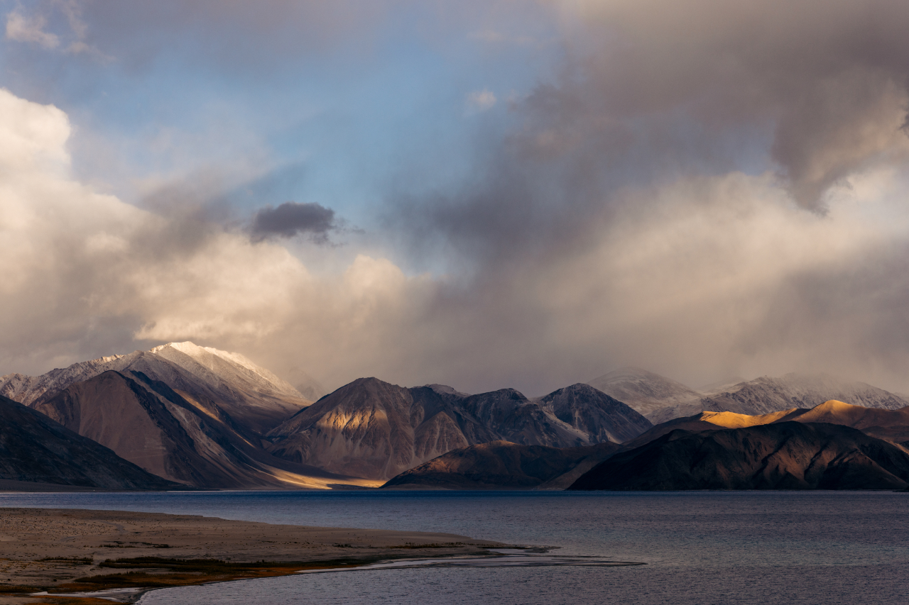
The goal of the day was to reach the lake, it was a very long day with 2 high passes. The lake is at 4225 meters.
Slowly going “down” to the lake.

And finally I reached the lake at 5pm. With a bit of clouds. Still took some photos but the next morning it would be much better for photography.

Sleeping here in october is a challenge. I wanted to shower, I was told I could shower with hot water the next morning. The next morning I was brought a bucket of about 5 liters of hot water. Yeah, no, I will pass, thank you. When it’s about 3-4°C inside the room, you don’t really feel like getting wet with such a small amount of water.
Before that shower story I went out early to catch the light on the moutains around the lake.


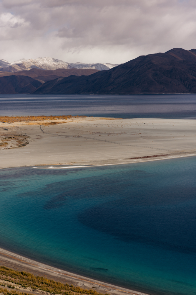
This lake was made famous by an india move, the 3 idiots, and is also the highest brackwish (salty) water lake in the world, which half of it belong to India and the other half belongs to China.
The color of the water when the sun hits it is very beautiful.

Time to leave the lake area, it’s too cold for me and everyday my trip is getting more and more difficult because of the weather and the season ending. I have to keep moving if I want to visit the other places I have planned.

Next in my list was the village of Hanle. The starting point for most people who want to reach the highest pass and motororable road in the world as of today.
Hanle is also renowned for being the Indian Astronomical Observatory, a very dark area and “close” to the stars.
I decided to take the long way there, to go up another pass, the Kaksang La pass, at 5400 meters.
Right before the top of the pass, there’s a pretty cool looking lake. Mitpal Tso (Tso means lake in Tibetan)


Made it to the top, time to go down.

And the end of the pass, there’s another lake, Yaya tso. Amazing colors.


The last stop before Hanle was Nyoma. I picked up some petrol from locals selling it in bottles and after a quick snack I kept going.
From Nyoma to Hanle the road is very flat, this area is like a big plateau. The Hanle river valley.


I rolled into Hanle late in the afternoon, only to discover that finding a decent place to sleep was easier said than done. As it turned out, a local wedding had the entire village celebrating—and with it being the end of the season, tracking down an open homestay turned into quite the ‘adventure.’
I went out at night to snap some photos of the stars.


The next morning was the day, the day to try and reach Umling La, the highest motorable road in the world (as of 2025 it still is).
I packed all my stuff on the bike and left.
This is the Hanle monastery, very dramatic location.

From Hanle, the plan was to ride across Photi La (5,525m), summit Umling La (5,799m), then loop back to Hanle via Photi La again. There is another route, but I’d heard the road was rough—and honestly, by this point, I was done with the area. The cold and basic accommodations had worn me out.
On the way to from Photi La


Down the other side.
Umling La might be the highest motorable pass in the world, but it was also the most boring one I rode in the area. Sure, it’s cool to say you’ve been there—but if you actually enjoy riding and are short on time, I’d say skip it.

And since everyone leaves from Hanle at around the same time in the morning, the pass can get very crowded.

Back down Photi La into the Hanle river valley.

This valley is really a beauty.


Made it back to Nyona where I spent the night and took some more astrophotos.

This was from the homestay parking lot.

The next morning, I headed back to Leh. I skipped the other famous lake in the area, Tso Moriri—by this point, I’d had enough of the cold and was ready to move on from the region for now. But it’s just another reason to return someday.
In Leh, I relaxed for a few days, took care of some things on the motorcycle, fixed my jacket zipper, edited some photos, and prepared for the next leg of the trip—toward Kashmir.
If you are curious about doing this trip, it took me 14 days, but if you are in season I’d recommend a few extra days to enjoy a bit more.
See you in the next post! 😉